Today we hiked 22.4 km to Portomarin. The first photo is of the steps leading up into the city of Sarria, where we started today. You can see the yellow arrow at the bottom of the steps, letting all the pilgrims know that this is the path they are supposed to follow. We actually already walked up this set of steps 2 times yesterday, first when we were exploring Sarria, and later when we went out to dinner. By the way, we found an Italian place that served a Pilgrim's menu for 10 Euro. It was great to have something else to eat other than chicken, fish or very thin steak. It was so good, we stopped by the same place for breakfast, which was a buffet for only 5 Euro. A nice change for us.
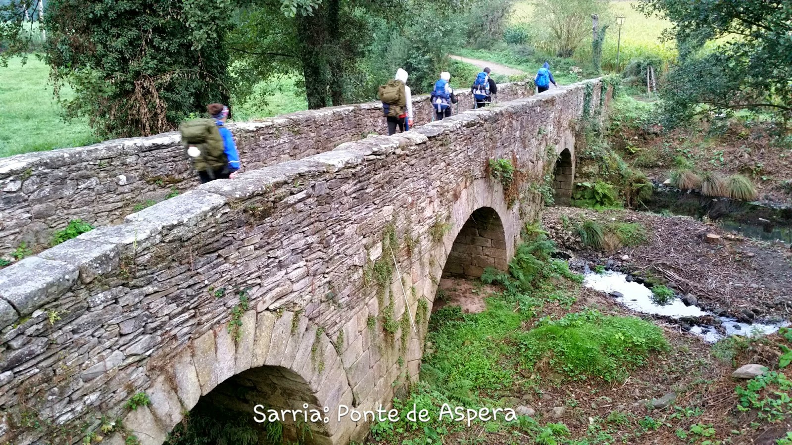
The second picture is of a bridge leaving Sarria. Our guidebook said the name of the bridge was Ponte Aspera, which means Rough Bridge. And it was an accurate name, as it was extremely bumpy crossing it. I can't imagine riding a bike on it. As mentioned in yesterday's blog, we are also seeing a significant increase in the number of pilgrims on the Camino. We met a couple from Milwaukee who just started today from Sarria. Add in the 50 teenagers. We also met two couples from Seattle, all around 60 yrs old. However, they've been hiking since Pamplona. One of the couples even hiked across the USA about 10 years ago. They said it took them 6 months and 3 weeks, and they only planned in advance for roughly 25% of the places they stayed. The rest of the places they slept, they just relied on the kindnesss of strangers.
The final picture is of the bridges leading into Portomarin. You can see the city in the background (population roughly 2,000). If you look closely, you'll notice over Linda's backpack an older, smaller bridge. Our guidebook says the original bridge was from medieval times, but back in 1962, they built a dam which created a reservoir in this valley. The lower bridge is what was used previously. The newer, higher bridge was built with the dam. You can see that the water must be low relative to where it normally is because the older bridge easily crosses the water right now (there's also a white ramp to the right of the old bridge which ends where the water should be beginning). I also included a picture that Linda took from up on the higher bridge (which we had to walk over), looking down river. You can see that a lot of the stone foundations are still in place from before the dam. Our guidebook says they did move a few things before creating the reservoir, like the 12th century cathedral and some other historical monuments. But they left everything else. I guess when the reservoir is high enough, it's all just under water.


No comments:
Post a Comment